
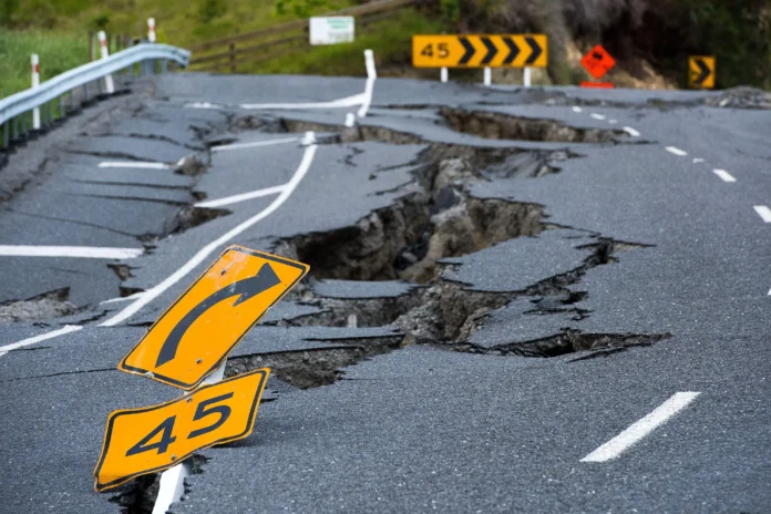
A Kermadec earthquake measuring magnitude 5 struck the Kermadec Islands region near New Zealand’s northeastern waters. The earthquake occurred offshore, according to seismic monitoring information reported following the tremor. Authorities and monitoring agencies continue observing the area for further seismic activity. However, the initial information indicated no immediate reports of major damage or widespread disruption.
The Kermadec Islands sit along a highly active section of the Pacific Ring of Fire. The region experiences frequent earthquakes because several tectonic plates interact beneath the surrounding ocean. Consequently, seismic events can occur regularly across the wider Kermadec-Tonga subduction zone. Scientists closely monitor these movements because stronger earthquakes can occasionally develop within the region.
The magnitude 5 tremor occurred offshore from New Zealand, keeping the event away from major population centres. Nevertheless, earthquakes in the Kermadec region can attract attention because of their location near important submarine fault systems. Monitoring agencies therefore assess the depth, location, and strength of each earthquake after detection. These measurements help determine whether the event could create additional hazards.
Earthquake monitoring networks use seismic stations to detect ground movement and calculate an earthquake’s characteristics. Initially, agencies record preliminary information before refining the location and magnitude through additional analysis. As more seismic data becomes available, experts can update their assessments accordingly. This process helps authorities provide accurate information while avoiding unnecessary public concern.
The Kermadec region forms part of one of the world’s most active tectonic environments. The Pacific Plate moves beneath the Australian Plate along the Kermadec Trench. This geological process creates intense seismic activity and contributes to the formation of deep ocean trenches. Moreover, the same tectonic environment can generate earthquakes of considerably different sizes.
Although a magnitude 5 earthquake can produce noticeable shaking near its epicentre, offshore events often limit direct effects. The actual impact depends heavily on the earthquake’s depth and distance from populated areas. Therefore, authorities assess more than magnitude when determining potential risks to communities. They also examine whether the earthquake triggered unusual changes in surrounding seismic activity.
New Zealand maintains extensive monitoring capabilities because earthquakes remain a significant natural hazard across the country. Agencies track seismic activity around both the main islands and surrounding offshore regions. Furthermore, monitoring systems provide information that supports emergency planning and public safety measures. These systems become particularly important following earthquakes near submarine fault zones.
The offshore location also makes tsunami assessment an important part of regional monitoring. Not every earthquake produces a tsunami, and several geological conditions must occur simultaneously. Generally, authorities examine the earthquake’s magnitude, depth, and movement of the seafloor. If those conditions suggest a potential threat, relevant agencies can issue warnings or advisories.
For the latest event, available information did not indicate a significant tsunami threat or major consequences. However, monitoring agencies typically continue watching the region after an earthquake occurs. Aftershocks can follow an initial tremor, although their occurrence and strength remain difficult to predict. Residents and maritime operators therefore rely on official updates for reliable information.
The event also highlights the continuing geological activity surrounding New Zealand and its offshore territories. Scientists use individual earthquakes to improve understanding of tectonic processes across the Pacific region. In addition, accumulated seismic data helps researchers identify patterns and assess long-term earthquake hazards.
The magnitude 5 event serves as another reminder of the region’s active geological conditions. While the earthquake did not immediately indicate widespread disruption, continued monitoring remains important. Authorities can respond more effectively when seismic networks provide timely and accurate information. Overall, the Kermadec earthquake underscores the importance of earthquake monitoring across New Zealand’s surrounding waters.